
Callum
The Via Dinarica is advertised as a cultural experience, but usually we’re just in it for the mountains.
Not so today.
Today the most memorable thing has been the hospitality and friendship of just about every local we passed (with the possibly exception of those who ‘marked’ the ‘route’… we’ll get to that). We were offered lifts, food, drink and shade by countless strangers, turning a day of arduous walking into a lovely experience.
But I’ll recount it from the beginning, from this morning, when all I knew about the day was that our seemed likely to rain.

The icy spring waters of Zabojsko jezero.
Awake but drowsy, Kris urged my impressionable morning self to make good on my naïve promise of last night and go for a swim in the lake.
I dipped my toe in with trepidation, though I was still too sleepy to have much conscious thought. It was brisk, but the clear water seemed inviting. Tadpoles circled in Van Gogh spirals, twisting through the bubble-clad leaves of aquatic plants.
I made the plunge, and, all of a sudden, I wasn’t sleepy any more. Any warmth the water held was confined to the top couple of inches. It wasn’t a long swim, but I felt good once I was out.
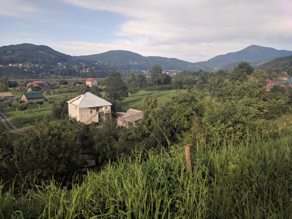
We packed slowly, not feeling any great excitement for today’s hike. For starters, Zabojsko jezero is in a valley, so first order of the day was to climb up a steep slope. But more than that, It’s really starting to feel close to the end. Those German girls we met yesterday said they were eight days in. Eight! That seems so achievable. No matter how long the walk is – an hour, a day, a week, a month – it seems to be that final 10% where you really have to push yourself to finish, and it feels like we’re reaching that point now. I’m still really enjoying the hike, but I’m also ready for a rest. A proper rest, not just a rest day.
Today our plan was to walk to the city of Mojkovac, passing though a series of small localities and hamlets to get there. Not a day of stunning mountains, but no reason not to be nice in its own way.
Heading off from the lake, we started by attempting to follow the CT-1 route, which was marked leading up from the road. It didn’t take long to realise that this path is ignored by most hikers for the good reason that it’s more or less a scrubby cliff. Furthermore, the neighbouring road is nicely graded and easy to follow, so we quickly bailed, though not before we’d picked up that unpleasant hot prickling feeling you get from bush bashing through weeds.
The muddy vehicle track eventually solidified into an access road for a small shepherd’s settlement, but it wasn’t to last: our route snaked off into the hills, branching into numerous fractal paths that defied any map’s attempt to record them. Those little trails must have evolved in recent years, because our GPS track seemed to ignore clear routes in favour of random hills and unmarked gullies. There were marker dots, but they were so infrequent as to be useless; spotting a dot was more like seeing a nifty-looking lizard: interesting, but not navigationally valuable. It didn’t take long before we started to plot our own course.
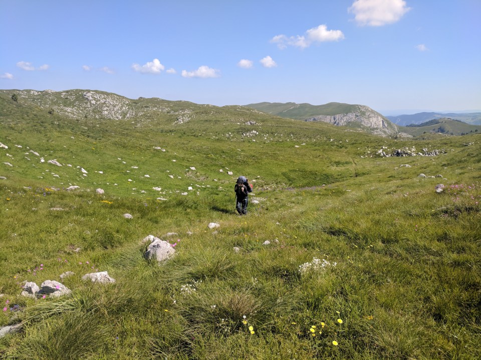
Kristen floats through an endless ocean of green.
With no reliable GPS track, and no clear route, the going was slow. We both just wanted to get this section over, but the world was against us. Firstly I got something sharp stuck in my shoe, and, as shaking out my boots didn’t seem to work, I ended up just changing my socks. Then we got lost (again), following a valley rather than its neighbouring ridge. It was miserable, one of those sections that seems endless. I think Kris put it well yesterday: “Oh my lord, how on earth did I walk myself into this… and how on earth am I going to walk out?!”
So it was a pair of tired hikers who slumped into another shepherd’s village for lunch, giddy with happiness at the sight of an easy-to-walk-on road. There weren’t many people around, but a line of five or six dogs tied up with short stretches of rope made up for them in noise. They barked like mad until we passed. It was quite sad, seeing how they must spend their lives, tied up with no shade. And it always seems to be the chained dogs which bark.
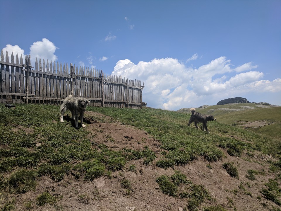
No life for a dog.
Lunch was just a quick affair, tempered by the knowledge that we still had twenty odd kilometres to go. We prayed that it would remain on roads – any more navigational troubles and we probably wouldn’t make it to Mojkovac.
Pottering on our way out of the village, a tiny red car pulled up beside us. Tied to the back was a horse, which was in turn followed by a foal. I don’t remember much of the conversation we had with the driver – it was mostly sign language anyway – but this was to be our first offer of a lift for the day. Alas, we continued our policy of not accepting lifts, and the little red car drove off, horses trotting along behind. Due to the bumpy roads and horses, he was only going slightly faster than us anyway, but it was a nice offer, especially as he went to the effort of stopping his car, which required a lot persuasion to start again.
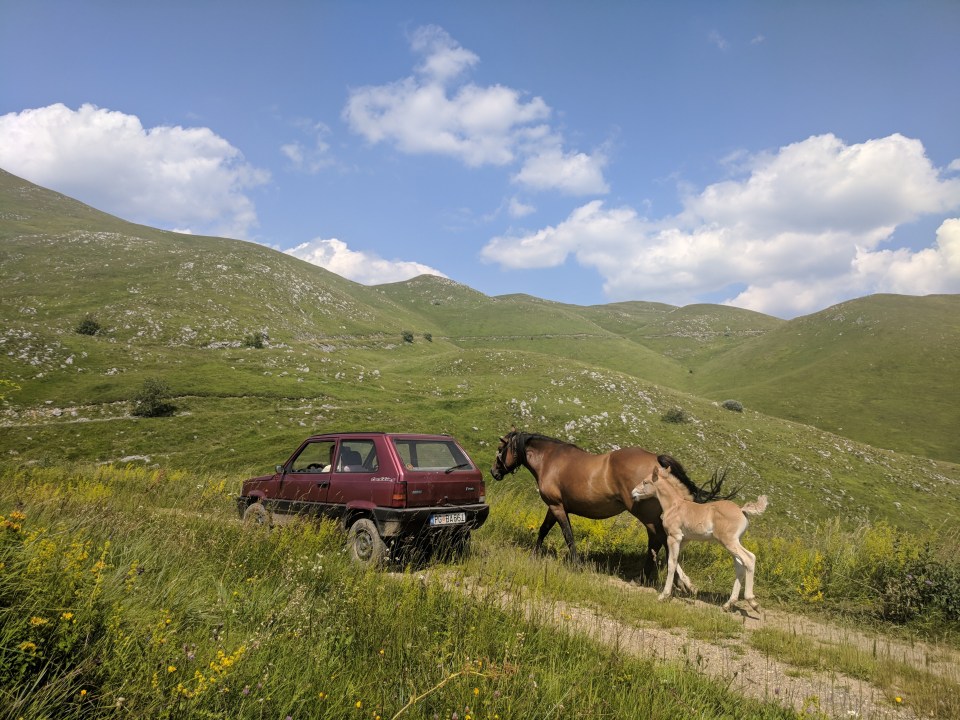
That’s really putting the car before the horse.
That was our first offer of a lift, but by no means the last. Of the eight cars which passed us this afternoon, no fewer than five offered us a ride to Mojkovac (including the little red car again, after we later overtook it). Spoilers: we didn’t take any of them.
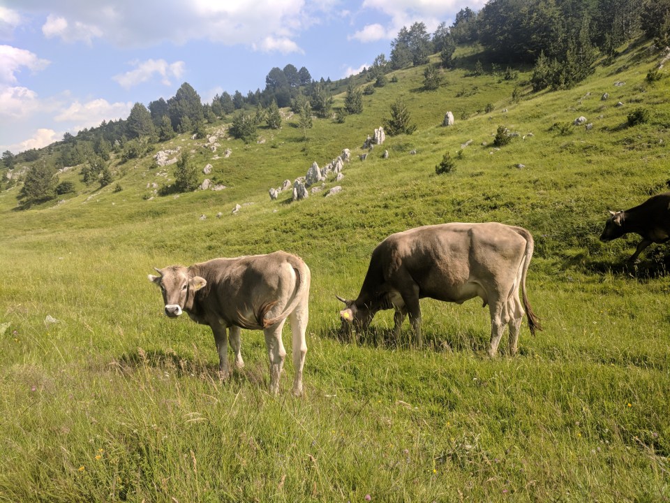
Some ponderous lawn mooers.
This wasn’t the only way the locals expressed their friendliness. Heading down a particularly dusty patch of road, our eye was caught by what looked like a broken down car – parked on the side of the road, hood open with a couple of men wandering about. One of the men came towards us, shirt open to the belly button and speaking in rapid Montenegrin. I thought he was asking us for help, but once he realised we didn’t understand him, his whole demeanor changed. We found ourselves shaking his hands and being passed swigs of some sort of drink he was carrying with him. No refusals allowed.
We went through the usual mimes to convey the basics – from Australia, walking to Albania, going to Mojkovac tonight – and nodded blankly as he gave us some very detailed directions that went way over our heads. Then he shook our hands again, gave us another swig and drove off on the car, leaving us a little perplexed but also a little happier.
The meandering roads through those mountains were hard under foot, and it was these little interactions that kept us going. It wasn’t long before we were offered rakia by another old man walking along the road. This time we refused, as we still had a long way to go and the day was growing short, but we felt bad about it later. Perhaps it was this sense of regret that made us accept our third invitation for a drink, this time by a family.
We were hailed off the road by a curious head poking out the doorway of a tiny little hut, still some two hours short of Mojkovac. Before we knew it we were sitting with a biscuit in one hand, tea in the other, and yet another glass of rakia by our side. Arranged around us in a semi circle was four generations of a family, who streamed endlessly out of that tiny house, taking turns to talk to us. I have no idea how they all fit.
“How long to Mojkovac?” we asked. One of our hosts held up seven fingers – seven kilometres. Still a while, but I was encouraged that none of them seemed to think it was impossible.
The route down to Mojkovac is a matter of contention on the Via Dinarica forum: by all accounts it doesn’t actually exist. We were in no mood for (any more) bush bashing, so we decided on taking the suggested alternative route. That meant that instead of walking directly into Mojkovac along a ridge, we had to do a much longer (and steeper) road walk.
Soon my feet had completed their transformation into play-doh as we rounded the umpteenth switchback. Descending from our friendly plateau to the busy Mojkovac roads was like falling back into reality: no friendly locals offered us lifts or drinks anymore.
Our first view of Mojkovac. The town centre is still far away, nestled up against the hills.
It was a fairly dull walk, but thankfully the road was fully equipped with pavement so it wasn’t dangerous. My body was aching from the waist down, and I really just wanted to be in town already. At lunch time we had booked a riverside hut online, so there was no more decisions to make. We just needed to get there.
After an age, we found our accommodation (conveniently on the close side of town) and fell on to bed. Or at least, fell on to floor – we both felt too smelly to sully the clean sheets with our sweaty hiking clothes. It was a nice room, with lovely tables scattered around the garden and overlooking the river, but it was getting late and we didn’t want to linger.
Two showers and half an hour later we were sitting in a nearby restaurant, sipping wine and nibbling on the last of our grilled vegetables. If today started with a miserable climb, became a lovely series of encounters before returning to misery with a road walk, then things had alternated once more. This was definitely a good bit.
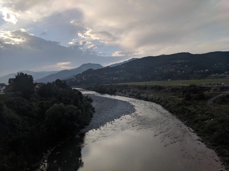
The slow flow of the Tara river.
Details
Montenegro, Stage 40
Start and end points: Zabojsko jezero to Mojkovac
Approximate distance: 34 km
Villages: Planinica – Ružica – Mojkovac
Features: Zabojsko jezero (Zabojsko lake) – Planina Sinjajevina (Sinjajevina mountain) – Planinarski dom Ckara (Ckara mountain lodge) – Serdar Hotel – Tara River – Supermarkets in Mojkovac (VOLI, others) – Guesthouses in Mojkovac (Tara Riverside Cottages, others) – Restaurants, cafes and bars in Mojkovac (Restoran Most, others)
