Kristen
The sun hits the tent just right in the morning. Warm and strong after the cool night beside the lake, it eases me awake and begins to dry off the dew that accumulates each night on the tent. Mmm. Time for a tiny sleep-in, as the sun gets to work. I love it when things happen simultaneously. It’s like being at home with the washing machine going; despite the fact you’re not actually doing anything, the washing is still being done and thus I feel productive! I love that.
From Gornje Bare jezero, we walk a few quick kilometres along leafy roads to Donje Bare jezero (Gornje meaning ‘upper’ and Donje meaning ‘lower’; I don’t quite know what Bare means, so we’ll have to leave it at that). At the lake is a beautiful kuća. It happens that a group of four friends from near Sarajevo are staying there for a few days. A woman with clear, olive skin and hair died a lovely pale-orangish blonde fills our water bottles and offers us Bosnian coffee. We relax in the shade on the veranda, overlooking the deep green lake with the strong, silty coffee. “We are a poor country,” she says wryly, “But people always have enough money for a drink, a coffee, a smoke.” In a way, it sounds like a very nice way to live.
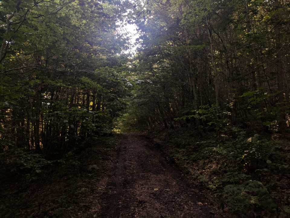
The leafy path from Gornje to Donje Bare.
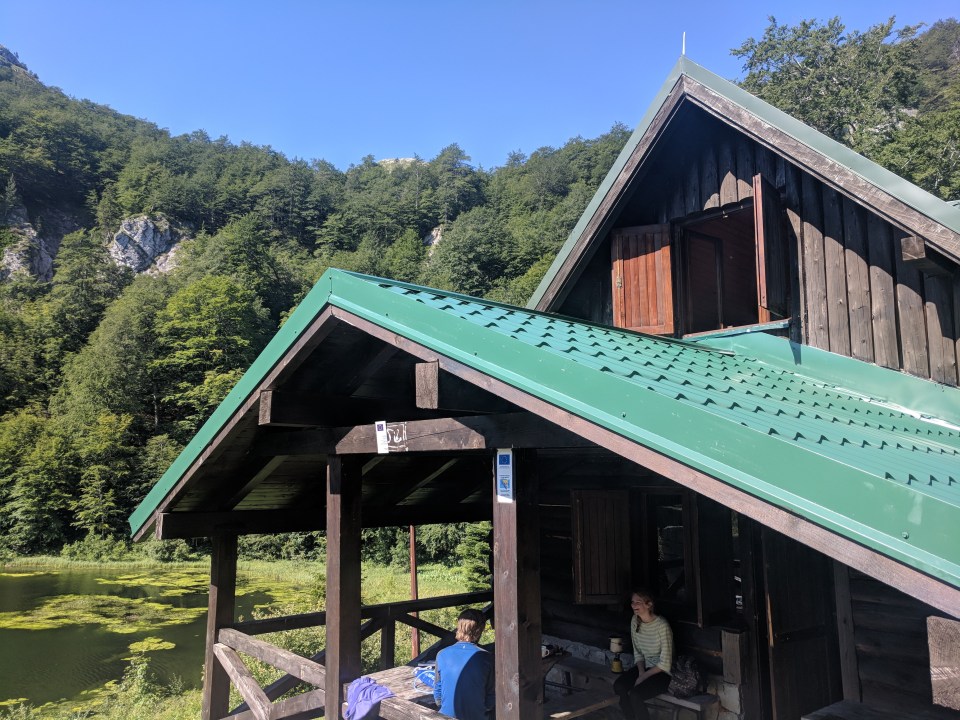
Callum enjoys hot coffee at Donje Bare kuća.
Past the kuća, we wander on through grassy fields, a large, rocky mountain range becoming clearer in the distance. One of those peaks is Maglić, the highest peak in Bosnia, lying right on the southern border with Montenegro. We’re almost through with Bosnia, perhaps my favourite country of the Via Dinarica so far. We’ve taken it nice and slow, but it still feels too soon to leave. It also seems a real shame to have missed Sarajevo, but we’ve lingered so long along the route – and we’ve got a messy border crossing coming up, which is most likely going to involve a bus – so we’re short on time.
Being outsiders from Europe and the Schengen zone, we’re a little more concerned about our border crossings than probably necessary. As such, our plan is to hike up to Maglić tomorrow from Prijevor (a mountain pass in Bosnia) via a really cool-sounding, slightly technical route, and descend on the Montenegrin side via Trnovačko jezero, a famous heart-shaped lake, before coming full circle back to Prijevor again. From there, we’ll return to the valley and hike east to a small town called Tijentište, from where we can get a bus through the official border crossing to a place called Mratinje in Montenegro. Mratinje is on the official Via Dinarica route, so we’ll simply hike onward south from there. If we reach Prijevor tonight, we’ll be across the border in two days time (apologies for the excessive amount of place names and logistics – this will all be on the test).

My apologies for this terrible way of explaining our route. The little red circle is Prijevor pass, where we’ll camp two nights and ascend to Maglić from on our circular day hike. You can see the heart-shaped splodge of Trnovačko jezero in blue. The thin black line crossing Maglić is the border between Bosnia and Montenegro, with Bosnia at the top and Montenegro at the bottom-right.
As we stride through the long, dewy grass, my feet stay happily dry and comfortable in my new hiking boots – ten days old now, I can barely remember what it was like without them. It seems so long ago that I was miserably hiking with soaked socks in those duck green Keen’s. I wanted to give the Haglöfs a solid 10-day chance to prove themselves (or not) before giving my judgement, so here it finally comes: they’ve been fantastic. They fit me well, deal with the slippery, rocky terrain, and are as waterproof as I could realistically hope them to be. Plus, they’re lightweight, even lighter, somehow, than my previous ones. I’m very happy. Unfortunately, my gear success comes amid Callum’s multiple gear failures, and the cow poo incident of yesterday.
A little way on from the kuća is a turn-off to a little view point called Borić. It’s meant to be a great view of the border mountains, so we head off along the path. In a few minutes we’re overlooking the huge form of Lica peak in foreground, with Maglić somewhere in the back.

The view from Borić viewpoint – definitely worth the walk
Before heading up towards Maglić, we first have to descend from the hills to a road hidden deep in the valley. As we descend, we meet a Danish couple heading upwards; Via Dinarica hikers! It becomes clear a few minutes later that they managed to get approval for crossing the border at Maglić, despite there being no official pass there. We’ve been trying for weeks to organise it to no avail. No problems, says our new best friend Kristoffer, giving us the number and email addresses of the Montenegrin officials which finally worked for him. This is fantastic news – hiking over the border at Maglić would be so much easier than the backtracking-bus schmozzle I described above. We’re so excited. But we’ll need time and internet to organise it – get a SIM, make the calls, wait for replies, resend our documents. This sounds like it would best be done in a slightly bigger city… We make an executive decision. We’re going to Sarajevo baby!!
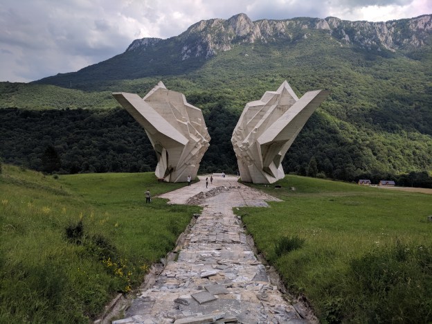
The last few kilometres down the hill and across to Tijentište fly by as we chatter excitedly about Sarajevo. It’s a city of awesome recent history. There’s a restaurant down in the valley where we can check the bus times, along with an impressive monument, thrust into the ground like a great pair of rocky wings.
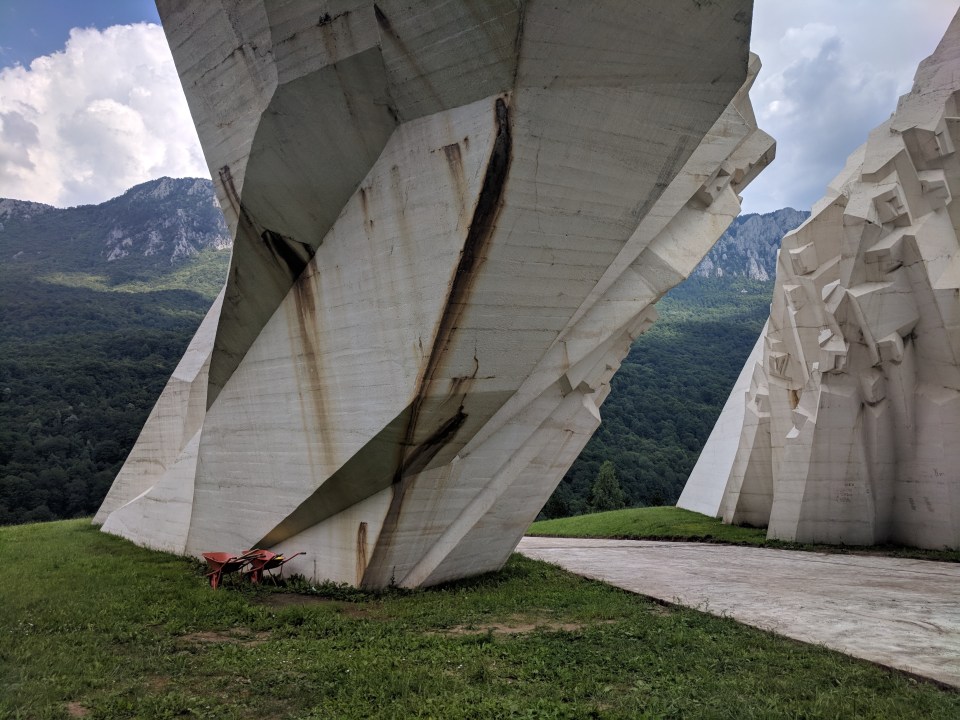
The spomenik (monument) to the Battle of Sutjeska, which happened here in 1943 as part of the Second World War.
The bus to Sarajevo should come at 6:10, emphasis on the should. We sit by the side of the road for an hour before the sleepy, old yellow behemoth finally shows up. I settle into a seat and watch through the window as towns, valleys and rivers flow past in a never-ending stream. Evening begins to fall around us. I close my eyes and rest my head on the window.
Details
Bosnia and Herzegovina, Stage 36 and Stage 37
Start and end points: Gornje bare jezero to Tijentište (followed by a bus to Sarajevo; bus leaves from opposite Hotel Mladost and the small lolly shop, before the bridge)
Approximate distance: 16.5 km
Villages: Tijentište – (Sarajevo)
Features: Gornje bare jezero – Donje bare jezero – Donje bare kuća (Donje bare mountain hut) – Borić view point – Tjentište spomenik (Monument to the Battle of Sutjeska) – Restoran nacionalne kuhinje “KOMLEN” (Komlen restuarant) – Small lolly/sweet shop in Tjentište – Hotel Mladost
