
Kristen
We both wake up tired this morning. An alarm was enthusiastically set for 6:30 am, but it’s almost an hour later and we still haven’t moved. My eyes are not ready to be awake. Either is my body. I think even my cheeks are still asleep.
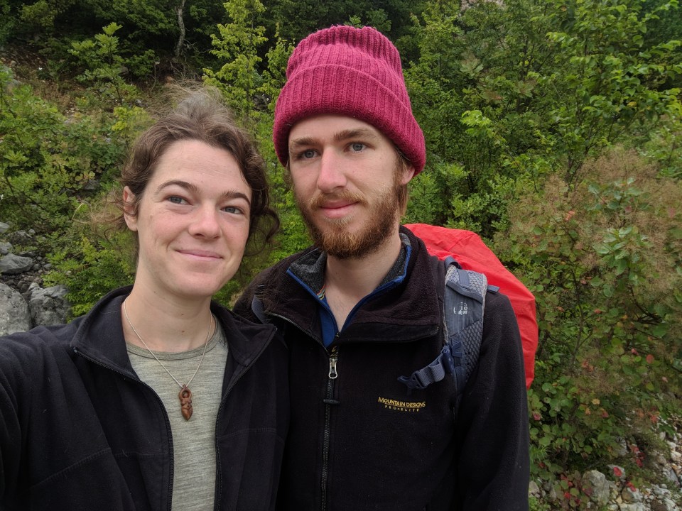
Why are we awake? Pre-summiting selfie.
Hiking up Maglić today has been a long time coming, and it brings with it a whole rush of thoughts and feelings. Wishing we could climb up the challenging route from Prijevor instead of from here, the long, gentle back route; wishing we had time to visit the beautiful, blue-green love-heart shaped lake below Maglić. But we tried our best, and can’t really have any regrets. Besides, I’m still excited – finally, we get to climb the highest mountain in Bosnia! Not in the manner intended, but we’re here, we’re ready and mostly awake. Besides getting to see Sarajevo, another huge benefit of climbing up from the Montenegrin side is that we don’t have to carry our packs with us!
We gather ourselves together, gut and repack my bag with just a few essentials (water, first aid kit, lunch, biscuits, chocolate… everything else is left behind at the lake) and have breakfast (we picked up muesli again in Sarajevo, and for once I’m actually thankful – eating crushed tea biscuits for breakfast has not been particularly sustaining).
I know it will be a huge climb today, but I’m not quite game enough to check the altitude difference. A signpost in Mratinje says it’s 5 hours 20 minutes to the summit which, for a 15 km climb up a 2386 m peak, actually sounds pretty good. We should get there for lunch time.
We climb steadily through the streets of Mratinje, back towards the Bosnian border. Houses sparsely populate the whole valley as we hike deeper and higher, not really clustered into a village at all; as if someone drew a line at the valley mouth and said that everything behind it was now designated ‘Mratinje’. As we slowly gain altitude on the roads, I find myself looking up at the cliffs and peaks towering hundreds of metres above us. Great swathes of land existing on another level, huge plateaus and hills up above the clouds. I can see how the border came to fall here. Today, I think to myself, we climb higher than everything I can see right now.
Past a small picnic shelter with a gushing spring, we leave the roads and hit the mountain paths. Striding through leafy forests, always up and up. Emerging from the forests, we hit some exposed, scree-covered slopes. I turn back towards the way we’ve come, overlooking the valley of Mratinje. The houses still look so close. Sighs.
We continue up into a grassy gully and follow it higher still. It’s so warm. It’s hard to believe we were actually worried about bad weather this morning.
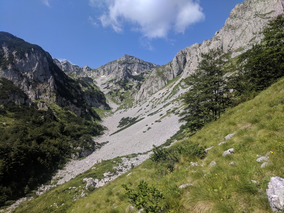
That huge scree slope? Oh yeah, that’s our route.
All the terrain so far is slow-going in its own way – a bit slippery or rocky or lumpy or gravelly or grassy – but we make pretty steady progress, both along and up the route. It never really gets too steep. This is a mountain with huge shoulders; more like climbing up a hunched, hulking troll than a pretty, triangular peak.
We reach the turn-off to Trnovacko jezero and stare wistfully down at its amourous form. Unfortunately, we don’t have enough time to hike all the way down and back up again, so we settle for loving it from afar.
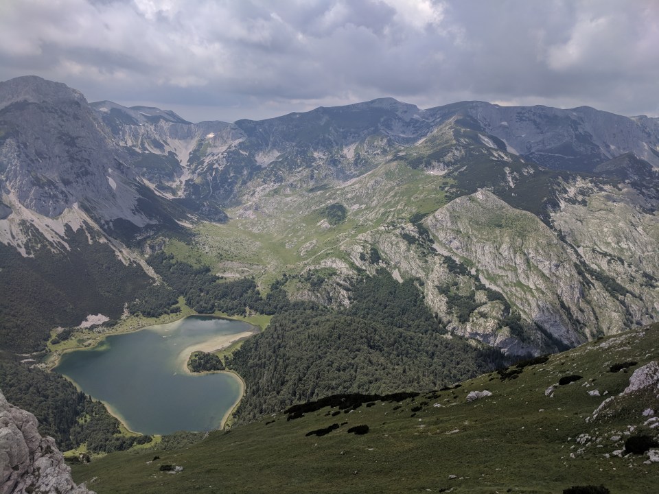
Trnovačko jezero, the beautiful lake below Maglić, seen from high above; some clouds have moved in, but don’t seem too threatening just yet.
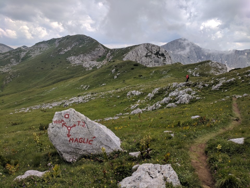
So instead of heading down to the lake, we turn right and head up the final 250 m towards Maglić. We’ve done most of the hard work by now. The summit is just 3 km onwards, along a beautiful turning ridge.

Maglić peak, in all it’s glory at 2386 m.
After many false lumps and bumps, the ridge finally reveals its pearl – little, rocky Maglić poking up at the very end, identifiable by a stiff metal flag fastened securely to the very highest rock. A tiny bit further, a small scramble and we’re there. Ahah!
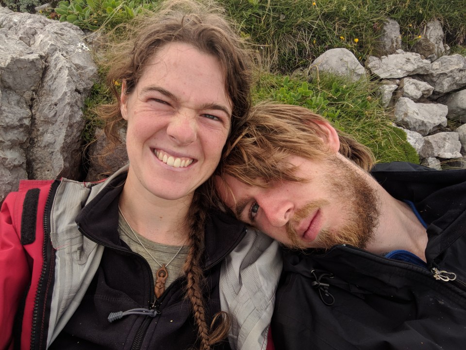
Summit selfie! Do we look like better people? I think so.

Maglić’s metal flag, decorated with countless hiking club stickers from across the Balkans and the world; it even swings and spins around in the wind.
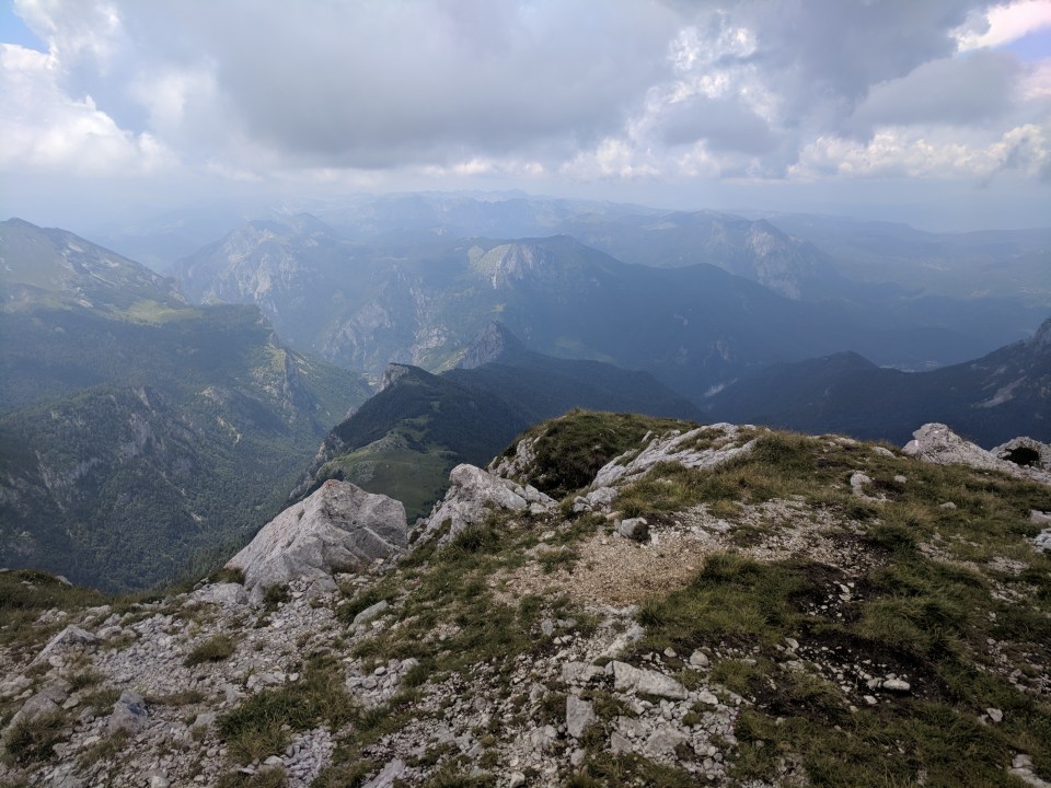
Looking out north towards Bosnia.
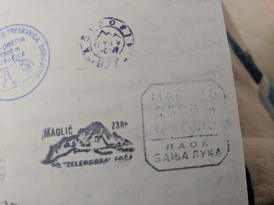
Two Maglić stamps! Perhaps not my best work, I admit.
We shelter from the wind to eat lunch at the very top of the peak. We’ve climbed this far, we may as well enjoy it and spend some time on top of this little bit of the world. We’re technically back in Bosnia now. Looking north, I can see back past Lica peak to the viewpoint at Borić which we passed through just a few days ago.
Happy and tired, we pack everything back up and start to retrace our steps back down the mountain. It feels good to be heading south, following the walk as we intended and making progress again. It takes a long, long time to get back down. As we slowly lose altitude, I can barely believe how much we must have climbed this morning. We spend hours walking back down to the road, and it’s not til 6 pm that we finally tramp down the last stretch of road in Mratinje towards our campsite.
Heading back down across the high grasslands towards Piva jezero.
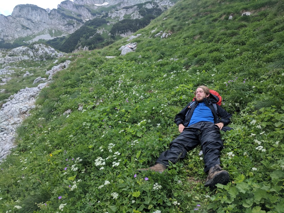
Callum falls asleep in the grass halfway down the mountain. Literally. He even does some little snores.
I still don’t appreciate how huge today has been until I check the GPS – we’ve walked about 32 km, ascended 1700 m and descended the same. On paper, this is one of the hardest days I’ve walked, but I feel surprisingly good. Ludicrous.
We light another fire and sit warm beside it at our Piva jezero campsite. No rain tonight, so we can enjoy the evening in it’s entirety. It’s been a really satisfying day; I feel like we’re back on track. What’s more, I remember that we’re actually in a new country now! I have no real idea what Montenegro will be like. It’s come so quickly.
Have we really hiked across three countries, and are about to traverse our fourth?
Yes, apparently (somehow) we have!
Bring on Crno Gora.
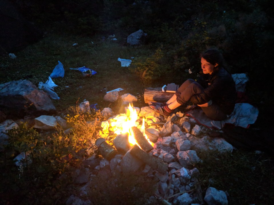
Our lovely, robust fire at Piva jezero, Mratinje.
Details
Montenegro and Bosnia and Herzegovina, Stage 38 (alternate, return climb of Maglić from Mratinje)
Start and end points: Small tent site beside Piva jezero, Mratinje
Approximate distance: 32 km
Villages: Mratinje
Features: Piva jezero – Maglić peak (2386 m) – (Trnovačko jezero, viewed from above)
