
Kristen
We’ve had two fairly full on days – 32 km up Maglić, plus our 32 km slog in the rain yesterday, both with significant climbs. Today, although slightly shorter, continues the trend. It’s going to be long and challenging, with a big ascent up to Bobotov kuk, which, at 2523 m is (or was) “arguably the highest mountain in Montenegro.”
A bit of an odd phrase that, isn’t it? You wouldn’t immediately think that the height of a mountain could be argued. However, there are apparently three other mountains in Montenegro, on the Albanian border, in contention for the title, which recent surveys show to be higher. So, there you have it! Still. It’s pretty tall.
Our hike up to Bobotov kuk takes us into a huge, very popular national park called Durmitor. It’s also the name of the mountain range, a big craggy massif that sits atop of the rolling meadows and small villages around it, dominating the landscape for kilometres. The tracks through Durmitor will be challenging – steep, rocky scree slopes – as well as very beautiful, with myriad blue-green lakes, waterfalls, rocky peaks and gentle, wooded valleys. Somehow, the walk over Bobotov kuk isn’t actually part of the official Via Dinarica route, but this certainly hasn’t stopped us before (we’re going rogue again! Although, rogue probably overstates it a little; many Via Dinarica hikers have discovered, suggested and walked this route before us). So, onwards and upwards!
We leave the Mitrić cafe after delicious breakfast and hot, sweet coffee. For the first few kilometres, our path winds down the small town roads from Nedajno to our first lake of the day (there’s quite a few, so be prepared), Šusicko jezero. With car access, fresh spring water, picnic tables and a kuća, the lake is a popular place for day walkers. From here, a gentle 7 km walk takes you across a beautiful valley of beech trees to a second lake, Škrčko jezero, perhaps even more beautiful than the first, plus a second kuća. It’s sunny and warm as we begin the walk. A really lovely day, and we’re walking well.
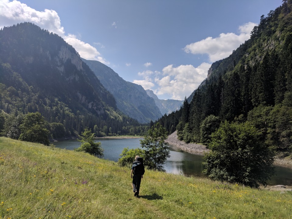
Callum walks across the grassy, sunny banks of Šusicko jezero.
A benefit of this being a popular route is that the track is gentle and wide almost all the way to Škrčko. We walk swiftly along soft leaf litter in the cool forest, talking about what it’ll be like going back to Sydney after being away so long – we want to retain our newfound fitness, be happier, go vegan, have kettles available at all times to fulfill our tea desires… we’re happy to dream about these idyllic things without worrying too much about the logistics for now.
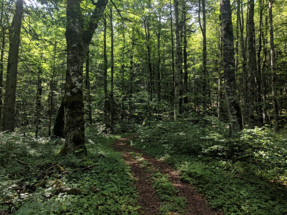
Flat and shady woodland walking along the valley. Durmitor is a very beautiful place.
About halfway along the valley, I suddenly notice some red liquid splattered on the white rocks and leaves at our feet. Hmm. Probably just paint splattered by some overenthusiastic marker dot painter; it’s pretty common to see a little bit here and there. But then there’s more… It looks fresh, wet and watery. Yeah, this is definitely blood. A group of day walkers we passed earlier warned us that an illegal deer hunter was in the forest; they’d seen a huge dead deer by the track. I imagine the hunter lumbering ahead of us somewhere with the deer over his shoulders, blood dripping from a wound or perhaps the animal’s mouth. It’s a little unnerving to follow the blood trail, but we do, all the way to Škrčko jezero. We never see or hear the hunter.
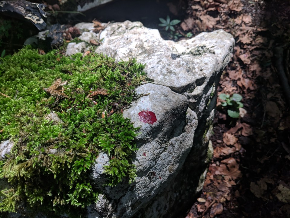
Eep! Blood stains.
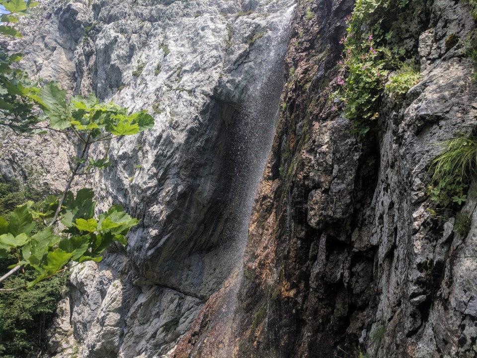
A waterfall heading towards Škrčko jezero.
Our walk between the lakes has been over easy enough ground, but it’s still taken a while. Add in our walk from this morning, and it’s somehow already 2 pm by the time we finish lunch at Škrčko kuća. The sign says it’s still three and a half hours to the summit of Bobotov kuk. Hmm. Getting a bit late. After summiting Bobotov, we want to camp as close as we can to Žabljak, a busy tourist town at the foothills of Durmitor where we’ll resupply food. Currently we’re thinking Crno jezero, a popular lake just outside of Žabljak… But it might be too popular to camp discretely; plus, it’s 8 km further on from the summit, descending quite steeply downhill. Sighs. We’d better get moving.

A view from the northern end of Veliko Škrčko jezero. A smaller lump of lake, Malo Škrčko, is hidden out of sight. There also may be two skinny-dipping Germans in there somewhere, whom we accidentally stumbled upon (hence no other photos of the lake).
The climb to Bobotov from here is over 700 m in altitude. As we steadily ascend the valley, I can see tiny people summiting on the horizon of the peaks. Little ‘whoops’ echo around the valley every now and then as they reach the top. As for us, our route rises steadily over rocks and grass to a small, round saddle, scooped smoothly out from the hills as if they were made of ice cream. After the saddle, we drop down again sharply before skirting round the base of some other peaks. It’s fiddly walking, sometimes requiring sliding and climbing. I keep checking the time – we’re doing fine so far, but I’m still anxious to keep up the pace.
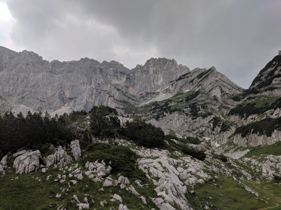
A huge wall of peaks… The tallest is Bobotov kuk, at 2523 m.
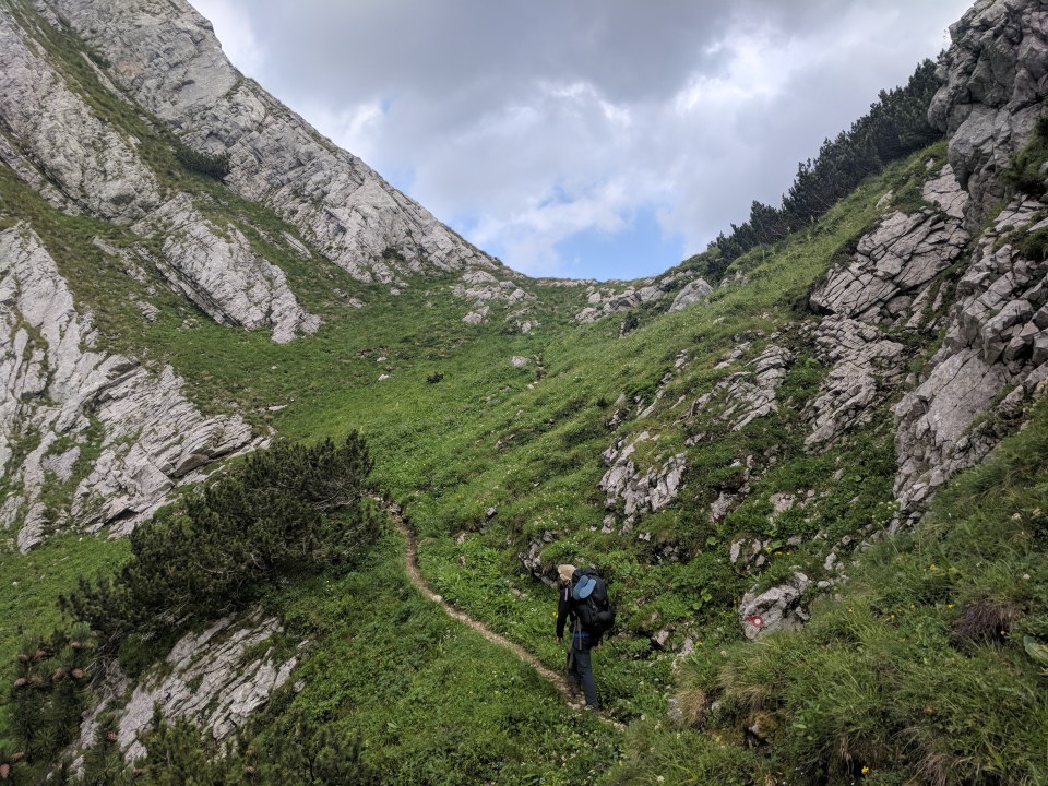
Callum hikes up to a small pass.
Finally we reach the base of the peak, where another small lake rests, called Zeleni vir. Happy people with small day packs, still fresh and clean in bright-coloured clothes, sprinkle the edges in post-summit luxury as we edge by, smelly and messy with our great lumps of gear. Hitting touristy areas can be a bit confronting; we’re obviously tourists too, but it’s not a crowd we quite fit in with. We clearly don’t fit in with the locals either, so it can be a little isolating at times. That’s why it’s so nice to visit places like the Mitrić cafe, which are designed for people like us; and so nice to meet other long-distance hikers.
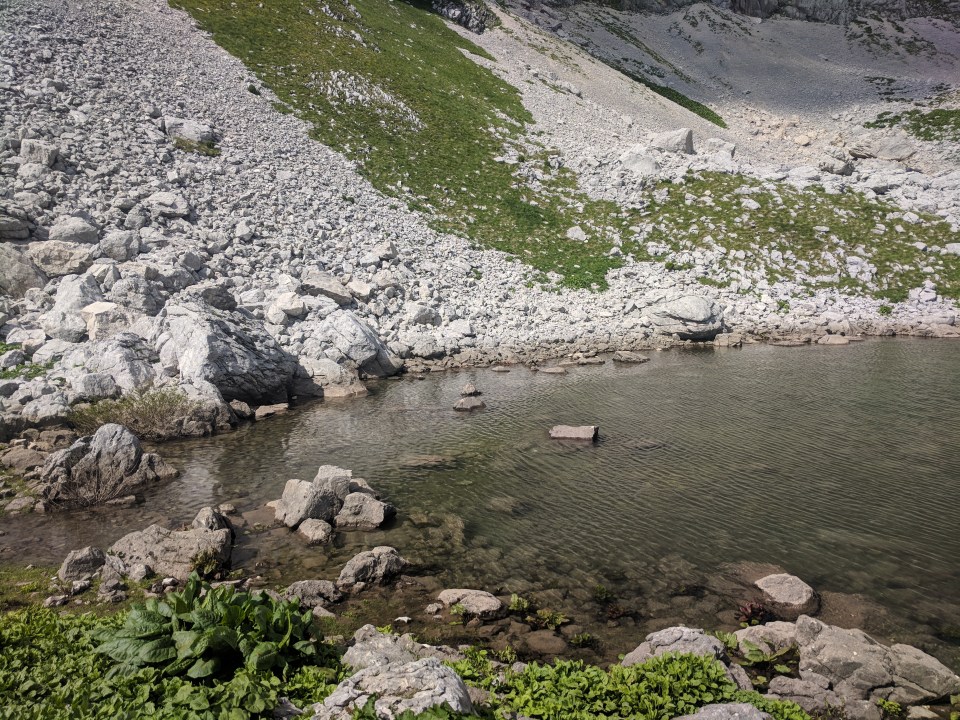
The beautiful spring water of Zeleni vir.
We leave the happy people and push out the last few hundred metres up to the peak. It’s steep and a bit muddy. We meet two Belgian summiteers heading down who pass on some advice; the track we want to take down towards Crno jezero and Žabljak is not in a good state. Large snow drifts are still obscuring the track. The Belgians were warned that some tourists had to be airlifted out recently trying to descend that way (whether due to injury or being stuck, I’m not sure), and were advised to take a different route. This is the last thing I want to hear as we finally reach the top at 5:30 pm.
The view is truly impressive. Expansive and majestic. We can see tiny Škrčko jezero below us, and the great, green striated lumps of mountains, folded into shapes all around us. Seeing those muddled striations makes me think of ice cream again.

The view from Bobotov kuk.
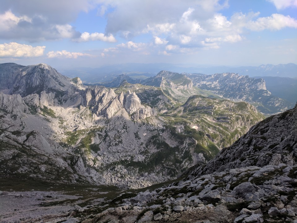
Looking out over Durmitor.
But we can’t linger. It’s nearly 6 pm and we have a challenging descent ahead.
We begin edging our way down the route. It’s rocky and steep, but not too bad at first. We make slow progress as the grubble crunches and rolls underfoot, but it’s manageable. Soon however, we hit our first snow drift.
It’s old snow, icy and tough. Slippery rather than soft. Neither Callum nor I have much experience with snow, nor do we have crampons or micro-spikes to help us. We edge around to a point where the ice looks safe to cross, and I tentatively head out. With each step, I gouge a little foothold in the snow with the side of my shoe. It’s going okay until, suddenly, I lose one foothold. I slip over, a little flush of adrenaline surging through my chest. I fall awkwardly on my bum. Ouch. It’s cold. Sighs.
Then I begin to slide. A metre or two at first, and I stop. Eep. I think I’m okay, but suddenly I’m sliding again, steeply and quite quickly. I gouge my fingers into the snow to try slow myself down and make little panicked bleats as Callum watches on helplessly. I have to make sure I hit the rocks at the bottom of the drift with my feet, not my head, but I can feel myself spinning sideways, and speeding up. Suddenly, my legs hit the rocks with a thud and it’s over. I’m sitting, panting, hands numb with cold, snow mercilessly shoved under my fingernails, my palms bright pink like carpet burn. I can’t move my fingers. I look back up the slope. I’ve fallen perhaps only 10 m, but I’m shaken. Callum hops round the edge of the drift on rocks and coaxes my hands into gloves. I’ve got a grazed bruise on my bum, but apart from that and my hands, I’m completely unscathed. We keep going, but even slower than before. I’m on edge and timid with my steps, especially as we navigate another few drifts.
It’s a beautiful valley, but I don’t really appreciate it as the sky grows pale with evening. The terrain gets a lot easier past the rocks and snow, but it’s still quite steep in places, and I’ve lost confidence in my feet. Seven passes, then seven-thirty, then eight. We’re still a long way from Crno jezero. We have enough water to pitch camp anywhere, but the ground, though grassy, is studded with limestone lumps. We keep moving.

Navigating a snow drift with Bobotov kuk in the background.
Callum rounds a corner a few hundred metres ahead and calls back to me: “Oh, a lake!” It’s a tiny thing in the bottom of a valley, so small we missed it on the map – we later learn it is called Lokvice. Great. Maybe we can just camp there. But then Callum calls again. He can see huts! And people! With tents!! It’s a tiny campsite in a flat, grassy saddle above the lake. How could we have missed this?!

Our view from the campsite, overlooking Lokvice jezero in the valley.
It takes another half hour to make our way down but it’s as we thought – a campsite, with a spring and a few shepherd’s huts, at place called Katun Lokvice. We chat for a few minutes to a couple from The Netherlands. They are so friendly and warm, and this campsite is such a lovely surprise, that I feel all gooey and useless. We set up the tent and make dinner as the evening fades away.

Evening falls and the crescent moon rises… All is well and peaceful.
I check the GPS. It’s says we’ve come just over 26 km. It feels like so much further.
Feet in socks, socks in sleeping bag. Comfortable and safe. I fall asleep dreaming of the sunny lakes of this morning. They feel like weeks ago.
Details
Montenegro, Stage 39 (Part 1 of an alternate route via Bobotov kuk)
Start and end points: Mitrić B&B, Nedajno to Durmitor camp at Katun Lokvice
Approximate distance: 26 km
Villages: Nedajno
Features: Mitrić B&B, Nedajno – Durmitor National Park – Šusicko jezero – Planinarski dom Šusica (Šusica mountain hut) – Škrčko jezero – Planinarski dom Škrčko (Škrčko mountain shelter) – Bobotov kuk (2523 m) – Katun Lokvice
