Callum
As usual, I’m feeling a little ungainly after our rest day. With my pack at its heaviest and my legs at their stiffest, it’s all I can do to waddle out of our apartment and into the blaring sunshine of the main road.
Somehow it’s already 10 am – we may have lingered a little over breakfast – but the road is strangely subdued. Instead of cars, the lanes are lined with TV crews and photographers, huddled together, or setting up their equipment.
Before we have time to wonder what’s going on, the church bells start thundering, with each of the half-dozen bells following a rhythm that has little to do with its neighbours’. Then an amplified voice starts singing hymns in the distance, and we see a great column of people marching down the middle of the road. It must be three-hundred metres in length, with at least a thousand people. In all the clamor, their absolute silence is quite striking, though many of the younger ones are grinning a little, as if they can’t quite take their own solemnity seriously.
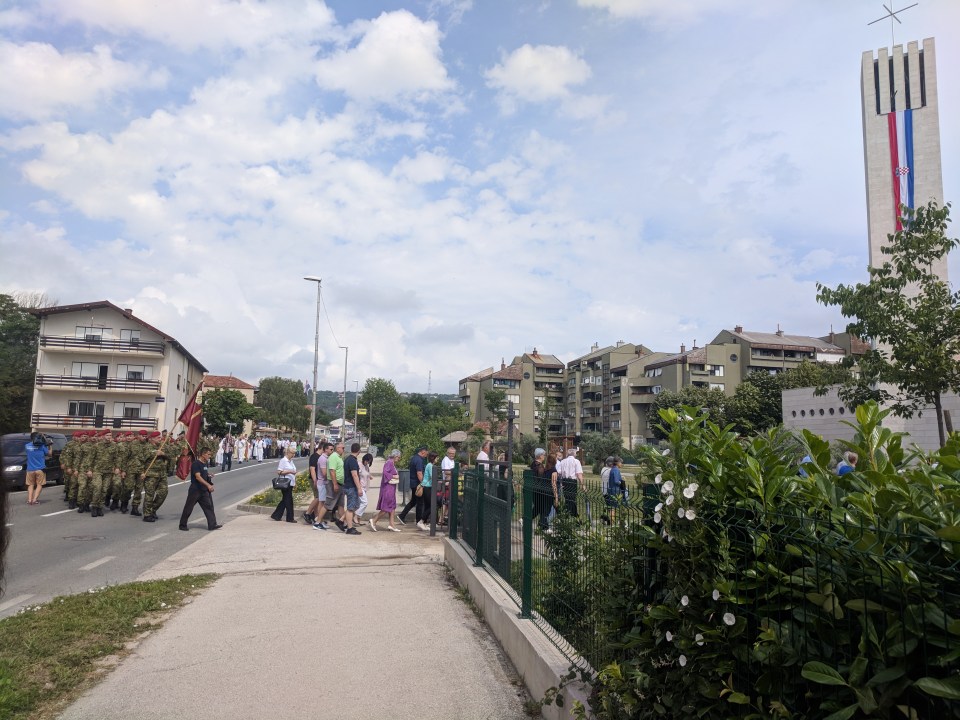
The parade, passing right by our apartment for the last couple of nights (brown building on the left).
By the looks of things, half the town has turned out. There are delegates from the church, the police, and the army (red, green and blue caps), though the vast majority seem just to be normal people. We’re not quite sure what it’s all for, but it’s a nice way to see off Knin, and, as they file into the church, we trundle on towards the outskirts of town.
It’s going to be a pretty uphill day. We’re making an approach of Dinara, the highest peak in Croatia at 1831 m. Winding through the back streets of Knin – vine clad houses on one side, veggie gardens on the other – we can see Dinara in the distance. Or at least we think we can; a thick, misty shawl lays heavy over the range, so none of the peaks look much higher than any of the others.

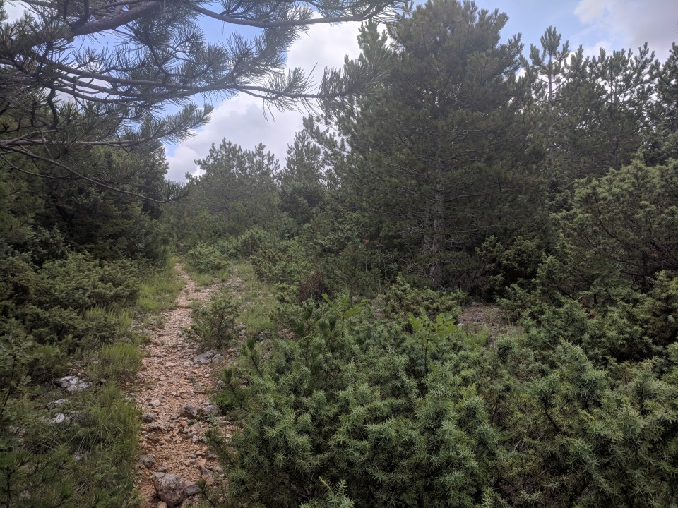
Sign quality here proportional to track quality.
As we swap tree-lined roads for an overgrown hiking trail, the world suddenly closes in and becomes oppressively humid. “Every step upwards,” I tell myself, “is a step towards cooler climes.” I have a feeling this route isn’t often walked: bold pines have spread their needles over the narrow path, making it a spiky experience.
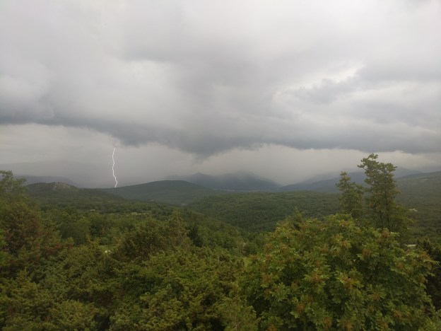
Not shown: those pioneering raindrops plummeting towards us, ready to patter onto our heads in just a few seconds time.
Gradually the pines make way for scrub, and we can see the sky again. In the three hours we’ve been walking the weather has wrapped around us in a great horse shoe of storm clouds. The air is still hot, though it’s started to sprinkle and could break at any moment. And, sure enough, it’s not long before we see flashes of lightning dancing over the ridge behind us.
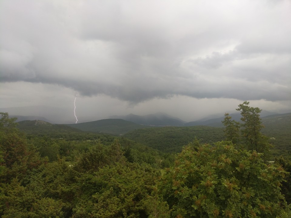
Kris is very proud of this photo.
We stop for a few minutes to try take some photos of the lightning – surprisingly hard to do – but then the rain sets in, and we figure we’re better off walking. Our socks are already wet, and there’s no shelter anyway.
We walk with the storm for an hour or so, but it gradually overtakes us, leaving the sky a harmless blanket of silver clouds. With the rain gone we decide to be a bit adventurous, and cut across the official route to visit some ruined tanks. We can see them in the distance, but they look tiny from here, like discarded toys. The metaphor comes readily to mind – I’m used to seeing tanks as toys, or in films, but, as we draw closer, these piles of rusty metal grow into an undeniable reality.
There’s three tanks in a row. It’s not clear if they were fighting each other, or some other long gone enemy, but whoever it was, they clearly lost: the flank of each carcass is a sieve of bullet holes.
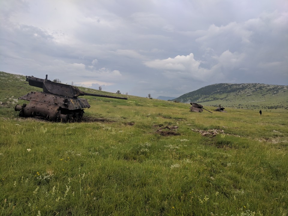
I’d love to know what happened here.
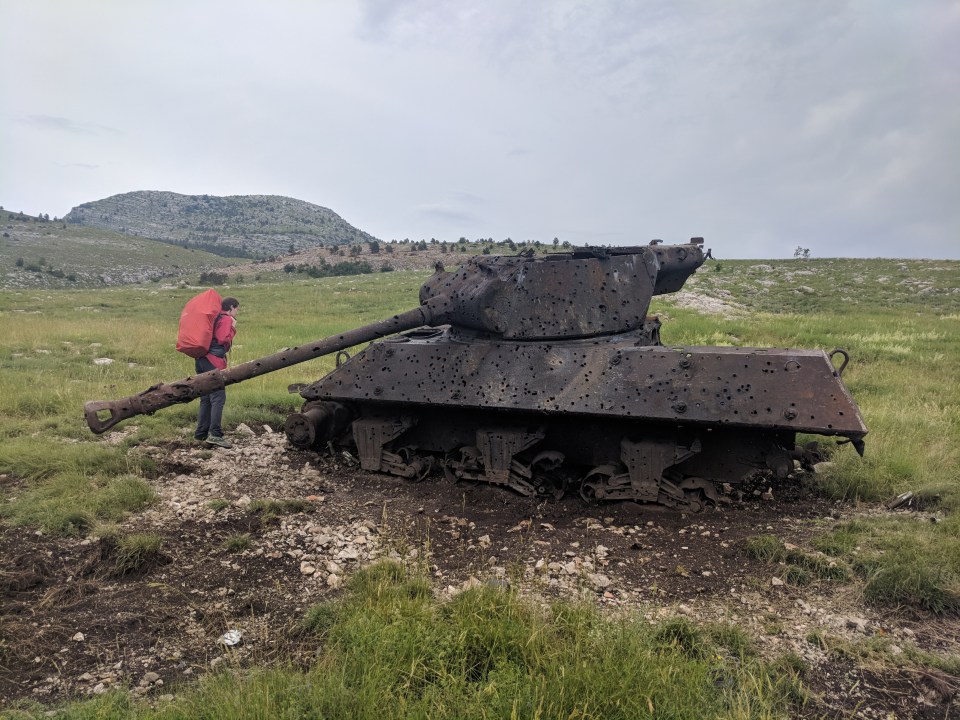
Human for scale.
I’m on edge. Logically, I know that anything dangerous has been cleaned up from here, but the ground is littered with military debris – shells, bullets, many things I can’t identify. So I tread carefully, sticking to rocks and exposed patches of dirt. The worst part is the copper wire hidden in the grass all through this valley. It catches on my boots, and I feel a slight tug. It’s hard not to feel like I’m setting off some sort of booby trap.
Pushing on, it’s only a few kilometres to Brezovac dom – another closed hut for us to sleep outside of. They’ve locked the well, but we catch some water dripping from the roof in one of the Trangia pots. It’ll do. I’m getting used to camping by these huts, and I’m actually starting to prefer it when they’re closed. It means we get the place to ourselves. I’ll just have to try and ignore the ‘No Camping’ sign.
At sunset the mozzies descend, and we retreat to the tent. It’s been a short day, but I’m feeling tired. Tomorrow we summit Dinara – our highest peak since Snežnik. It should be a good day.
Details
Croatia, Stage 22
Start and end points: Knin to Brezovac dom
Approximate distance: 10.5 km
Villages: Knin
Features: Abandoned tanks (south-west of Badanj peak) – Brezovac dom

I got goosebumps reading this and seeing those photos.. glad you’re both treading carefully xxx
LikeLiked by 1 person
Yeah, it was really unnerving. We’re still trying to find out what happened there.
– Callum
LikeLike